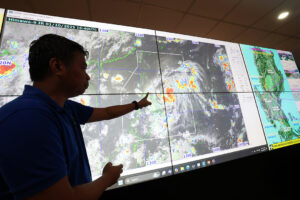
TROPICAL STORM Matmo, locally named Paolo, was expected to make landfall over the Isabela, Aurora area on Friday morning, as it kept its strength while moving westward over the Philippine Sea, the state weather bureau said on Thursday.
The storm was forecast to move westward over the next 12 hours, then west-northwestward throughout the forecast period. It could move southward depending on the strength of the high-pressure area located north of it.
The center of the storm was estimated at 530 kilometers east of Infanta, Quezon with maximum sustained winds of 75 kilometers per hour (kph) near the center and gusts of up to 90 kph.
“After crossing the landmass of Northern Luzon, it will emerge over the West Philippine Sea tomorrow afternoon and will continue moving west-northwestward until it exits the Philippine Area of Responsibility by Saturday morning,” the Philippine Atmospheric, Geophysical and Astronomical Services Administration (PAGASA) said in a 2 p.m. bulletin.
Paolo would continue to intensify while over the Philippine Sea and might reach severe tropical storm category on Thursday night.
“Further intensification into a typhoon prior to landfall is not ruled out,” the bureau said. “However, based on the intensity forecast, intensification into typhoon is highly likely once Paolo emerges over the West Philippine Sea.”
Tropical Cyclone Wind Signal No. 2 was raised over the central and southern portions of Isabela, the northern portion of Quirino, the northern portion of Nueva Vizcaya, the eastern portion of Mountain Province, Ifugao and the northern portion of Aurora.
Signal No. 1 was hoisted over Cagayan, the rest of Isabela, the rest of Quirino, the rest of Nueva Vizcaya, Apayao, Abra, Kalinga, the rest of Mountain Province, Benguet, Ilocos Norte, Ilocos Sur, La Union, Pangasinan and the northern portion of Zambales.
Also under Signal No. 1 were Tarlac, Nueva Ecija, the rest of Aurora, the northern portion of Bulacan, the northern portion of Pampanga, the northern portion of Quezon including Polillo Islands, Camarines Norte, the northern portion of Camarines Sur and Catanduanes.
The Philippines lies along the typhoon belt in the Pacific and experiences about 20 storms each year, with about eight to nine typically making landfall. It also lies in the so-called Pacific Ring of Fire, a belt of volcanoes around the Pacific Ocean where most of the world’s earthquakes strike. — Norman P. Aquino